Location: 3 miles southeast of downtown Norman, Oklahoma
Thermometer Probe and Rain Gauge
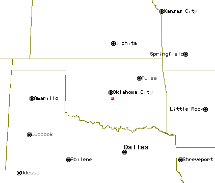
Location of Jeff's Weather Observation Center (JWOC) in relation to other cities in Oklahoma.
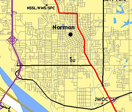
Location of JWOC in relation to Norman.
Nearest intersection: 250 yards NW of 12th Ave SE and State Highway 9.
Latitude: 35°10'57" north
Longitude: 97°25'27" west
Elevation: 1130 feet above sea level
Period of record: January 6, 2001 to present
Primary observer: Jeff Wear
Station set-up (as of Jan 2001): Digital max/min thermometer (probe is mounted 5 feet 6 inches above ground level outside north facing window and is shielded with a louvered styrofoam cup), All-Weather 4-inch rain gauge mounted on wooden post (top of gauge is about 14 or 15 inches above ground level), Kestrel 3000 (hand-held digital anemometer/hygrometer), Komelon 6-foot measuring stick (for snow measurement).
Nearby weather related points of interest: OKC Will Rogers World Airport (17 mi NW), National Weather Service/
Pictures of the weather station
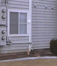
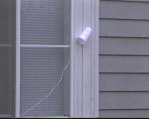
Thermometer Probe
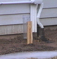
Rain Gauge
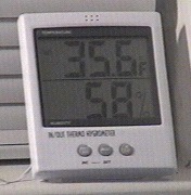
Digital Temperature Readout
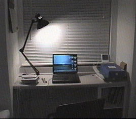
Jeff's Weather Workstation
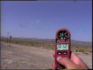
Kestrel 3000
This page was last updated 12-01-04 at 0024 CST