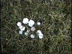
Following are captures of a supercell thunderstorm and the hail it produced in Covington OK on July 5, 2004. Please click on an image to see additional thumbnail images (NOTE: The first two images link to the same page).
| |
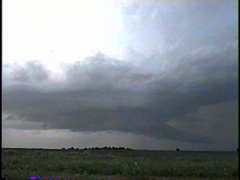
Looking north from 1 mile northwest of Marshall OK at 8pm CDT.Click here for more pics. |
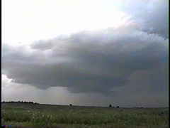
| The cloud base begins to take on a horseshoe shape as the rear flank downdraft blasts down. Click here for more pics. | |
| |
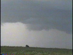
A close up shot of the rear flank downdraft wrapping around the wall cloud. This rear flank downdraft was filled with rain and hail which quickly blocked this wall cloud from my view.Click here for more pics. |
|
|
|
Back to Storm/Chase Summaries
Back to Jeff's Virtual Cyclone Cellar
This page was last updated on 7-06-04 at 0453 CDT