may 29, 2004
Between 10:13pm and 10:16pm CDT on May 29, 2004, I stopped on US 177 northeast of Wellston OK about 1-2 miles north of the Hwy 66 intersection to get video of this storm to the northwest. Although I did not see anything out of the ordinary while watching this storm, I did notice some interesting things upon reviewing the video later on.......
|
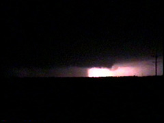
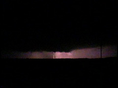
At 10:13pm, lightning illuminated an interesting lowering off to my northwest. I estimate this feature to be somewhere between the towns of Meridian and Carney.
|
|
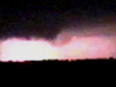
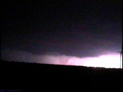
Same feature a few seconds later.
|
|
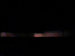
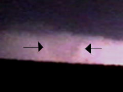
Feature is briefly front lit by a cloud to ground stroke at 10:14pm.
|
|
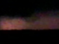
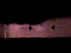
At 10:16 I see something interesting looking in the precip curtains to the southwest of where I saw the intial lowering. This feature showed up in subsequent flashes of lightning as well. Is this just a part of the precip curtains, or could this be something else buried within the precip?
|
Right now I believe the feature to the right of the precip curtains in the top three photos and the feature buried within the precip curtains in the bottom photo are two different things. For now I am not making a call whether or not either of the features was tornadic - although if either feature was tornadic I am a bit surprised I did not see any power flashes in real time nor on video. Either way these features were of great interest to me as an amateur radio operator reported a tornado four miles southeast of Meridian at 10:13pm - and these features probably would have been to the southeast of Meridian.
I would appreciate hearing from other chasers or spotters who were watching the storm as it tracked near the Meridian and Carney areas - especially those who also have pictures of these features. Any information would be appreciated - please e-mail me at jckssjeff@yahoo.com
Back to Storm/Chase Summaries
Back to Jeff's Virtual Cyclone Cellar
This page was last updated on 6-01-04 at 2346 CDT