|
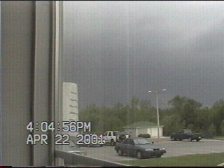
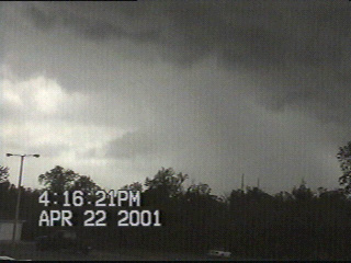
The sky darkens to the northwest as the squall line approaches.
|
|
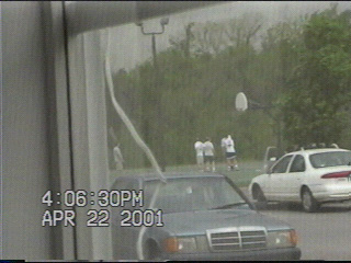
Not that it matters to these basketball players, who continued to play even though lightning struck nearby just seconds earlier. They finally went in once the rain started.
|
|
|
The sky begins to turn white as the hailshaft nears.
|
|
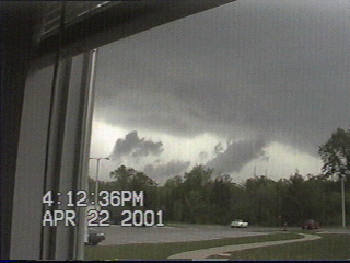
Oh no! Funnel cloud!!! Actually these are just "scud clouds", which develop beneath the bases of thunderstorms as warmer air ahead of the storm interacts with cooler air beneath the storm. Sometimes scud clouds are mistaken for tornadoes when they appear to connect with the cloud base, although scud clouds do not rotate. |
|
|
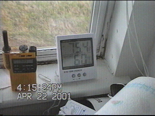
Before the storm moved overhead the temperature was 75.4 degrees. Watch how much the temp drops once it passes over. |
|
Clearing appears to the west as the hailshaft races north-northeast away from the area. No hail was observed at this location today, although 1 3/4 inch hail was seen west of Norman.
|
|
|
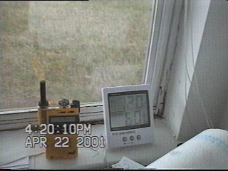
Temperature falls to 72.0 degrees as the storm moves overhead.
|
|
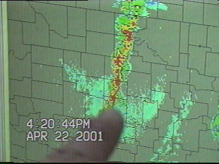
A radar image from 4:14pm showing the hail-producing cell racing off to the north-northeast of my location.
|
|
|
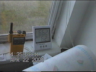
After 15 minutes of rain the temperature had fallen to 66.2 degrees.
|
|
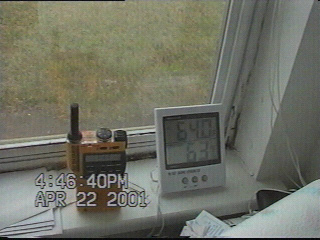
And by 4:46 our temperature was equal to our morning low temperature of 64.0 degrees.
|
|
|
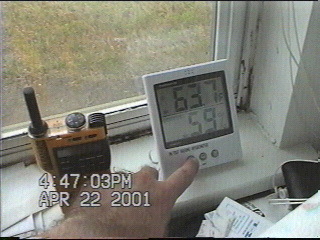
The temperature bottomed out at 63.7 degrees during the storm.
|
|
The 4:29pm radar image shows storms begin to reintensify in McClain County to our south while the hail-producing storm from the earlier images continues to speed through northeast Oklahoma County to our north. |
|
|
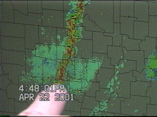
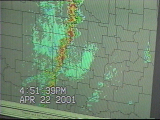
The 4:44pm image showed the storm that was in northeast Oklahoma County in the 4:29 image in Lincoln County while the storms that were in McClain County had moved into southeast Cleveland County.
|